The subject of the competition is a preliminary design for the Belo Brdo Archaeological Park complex in Vinča with buildings for the Visitor Centre and the Neolithic Scientific and Research Centre, and it includes:
- Preliminary urban-planning and architectural design for the area of the Belo Brdo Archaeological Park complex,
- Preliminary design for the mobile elements and objects supporting the archaeological site and arrangement of the Protected surroundings of Archaeological site
- Preliminary architectural design for the Visitor Centre’s building with associated outdoor space
- Preliminary architectural design for the Neolithic Scientific Research Centre’s building with associated outdoor space
- Preliminary design for the Archaeo Park area and the main parking of complex with accompanying facilities
- Preliminary design for the development of the coastal zone of the Danube in the area of Belo Brdo Archaeological Park – promenade, pier and revetment
The subject of the competition is also a preliminary design for the arrangement of the left and right banks of the Bolečica river adjacent to the zone covered by the competition, the area directly next to the traffic connection between the subunit of the Neolithic Scientific Research Centre and the coastal of the river Bolečica, as well as the area of the Danube coast from the border of the competition scope upstream in the length of about 600m, at the poll based level design.
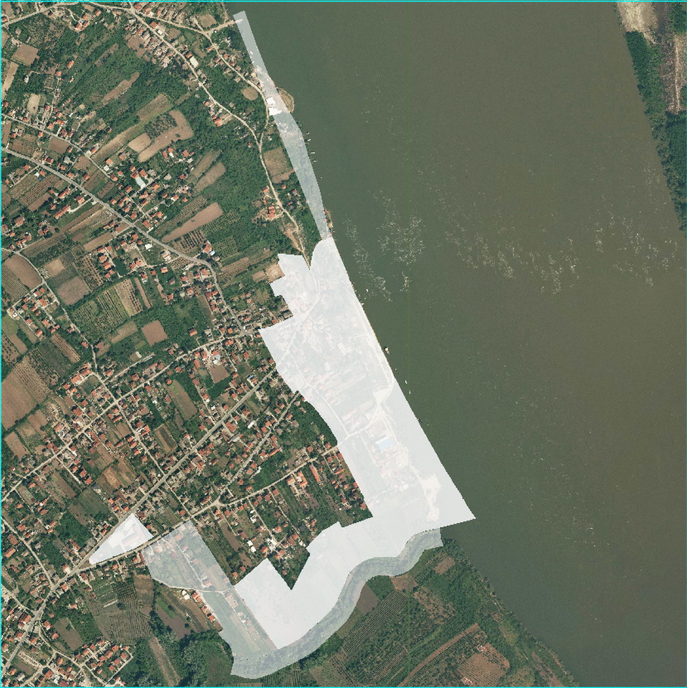
Fig. 3. Orthophoto image with the competition scope
The competition scope for Belo Brdo Archaeological Park in Vinča is shaped up by several interconnected spatial segments. The largest part of the area is bordered by the Danube (low water regulation line) on the east side – from the confluence with the Bolečica along the zone of the archaeological site (1st and 2nd degree of protection), then, on the north side, by an access road from Vinčanska Street to the bank of the Danube and the north boundary of cadastral parcels 1995/1 and 1995/4 of CM Vinča, then by the boundary of the protected surroundings of the archaeological site (2nd degree of protection) and the west border of c.p. 2028/47, 2028/48 and 2028/14 of CM Vinča, then by the northwest border of c.p. 2028/35, 2028/22, 2028/37, 2028/21, 2028/111, 2028/34, 2028/20, 2028/10, 2028/6, 2028/32, 2028/5 and 2028/30 of CM Vinča, by the northeast border of c.p. 2028/30 and 2028/31 and finally by the boundary of the SPSPA of Belo Brdo Archaeological Site in the south. West of the described space, the area covered by the competition includes c.p. 2027/1 (the old school plot) and 2027/4, as well as the roads connecting these segments: Nikole Pašića, Lebanska, Povljenska and Steve Simonovića streets.
The scope of the design proposal part of the competition includes the bank of the Bolečica within the boundaries of the regulation, from the confluence into the Danube upstream over the length of about 660.0 m, as well as the coastal zone of the Danube from the boundary of the primary scope of the competition northwards for about 600 m upstream.
The graphic presentation of the competition scope is provided in the competition documentation – I INFORMATION GRAPHIC APPENDICES, attachment BOUNDARY OF THE COMPETITION AREA WITH THE PRESENTATION OF THE SUBUNITS.
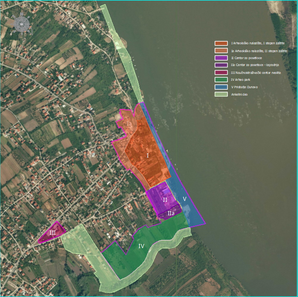
Fig. 4. Orthophoto image with the positions of the elements that are the subject of the competition