7.1.1 Current state of affairs – location and the construction fund at the location
The location where the formation of Belo Brdo Archaeological Park complex in Vinča is planned with facilities for the Visitor Centre and the Neolithic Scientific Research Centre, and the necessary accompanying facilities includes: the right bank of the Danube – from the confluence with the Bolečica in the south to the boundary the archaeological site (1st degree of protection), the area of the protected surroundings of the archaeological site ( 2nd degree of protection), the area south from the boundaries of the protected surroundings of the archaeological site to the regulation of the Bolečica between the regulation of the bank of the Danube in the east and the limits of competition scope in the west, the area along the left bank of the Bolečica in width of approx. 100.0 meters, that is, approximately 200.0 meters in the westernmost part and the old school and the active post office land parcels.
The future Archaeological Park complex encompasses five specific subunits:
- Archaeological Site
- Visitor Centre
- Neolithic Scientific Research Centre
- Coastal zone of the Danube – walking area, pier and revetment
- Archaeo park (within which the main parking lot of the Complex with accompanying facilities is planned)
mutually linked by free areas of the complex that include traffic, green and pedestrian zones, and other necessary accompanying facilities. The total area of the Complex in the scope of the Competition is 223,590 m2, or about 22.36 ha.
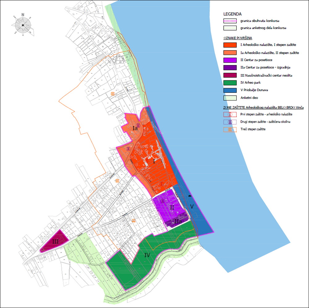
Fig. 33. Overview of the area covered by the competition with subunits
Subunit Archaeological Site
The archaeological site is an elevated plateau where people used to live and which in the past was right next to the river. The inhabitants of the Neolithic settlement depended on the river and that is why there are archaeological layers and the long duration in this limited space. The part that nowadays also constitutes the tourist focus is the place where life and settling were most intense, which is manifested through the 10 m high profile that naturally slopes, while the remains of the layers decrease in the directions of north, south and west.
The area of the Archaeological Site subunit includes the dominant part of the archaeological site – 1st degree of protection with the total surface area of around 52,050 m2 and most of the protected surroundings of the archaeological site – 2nd degree of protection of around 32,150 m2 with the total surface area of around 84,200 m2. The zone of the Archaeological Site subunit covered by the 1st degree of protection consists of cadastral parcels: 2014, 2015, 2016/1, 2016/2, 2016/3, 2018/1, 2018/2, 2018/3, 2018/4, 2019/1, 2019/2, 2020, 2021, 2022, 2023/1, 2023/2, 2023/3, 2023/4, 2024, 2025/1, 2025/2, 2025/3, 2026/1, 2026/2, 2026/3 , 2026/4, 2026/5, 2026/6, 2027/1, 2027/2, 2027/3, 2027/4, 2046/1, 2046/2, 2046/3, 2047/1, 2047/2, 2047/3, 2048/1, 2048/2, 2619/5 and parts of cadastral parcels 2619/5, 2619/6, 2619/7, 2619/8, 2619/9, all belonging to CM Vinča, and that section covered by the 2nd degree of protection includes cadastral parcels: 1992/1, 1994/1, 1994/2, 1995/1, 1995/3, 1995/4, 1996/1, 1999/1, 1999/2, 2000, 2011/1, 2011/2, 2011/3, 2012, 2013/1, 2013/5, 2013/6, 2017/1, 2017/2, 2017/3, 2017/4, 2049/1, 2049/2, 2728 and parts of cadastral parcels 1992/2, 1992/3 , 2017/5, 2017/6, 2017/7 and 2691/1.
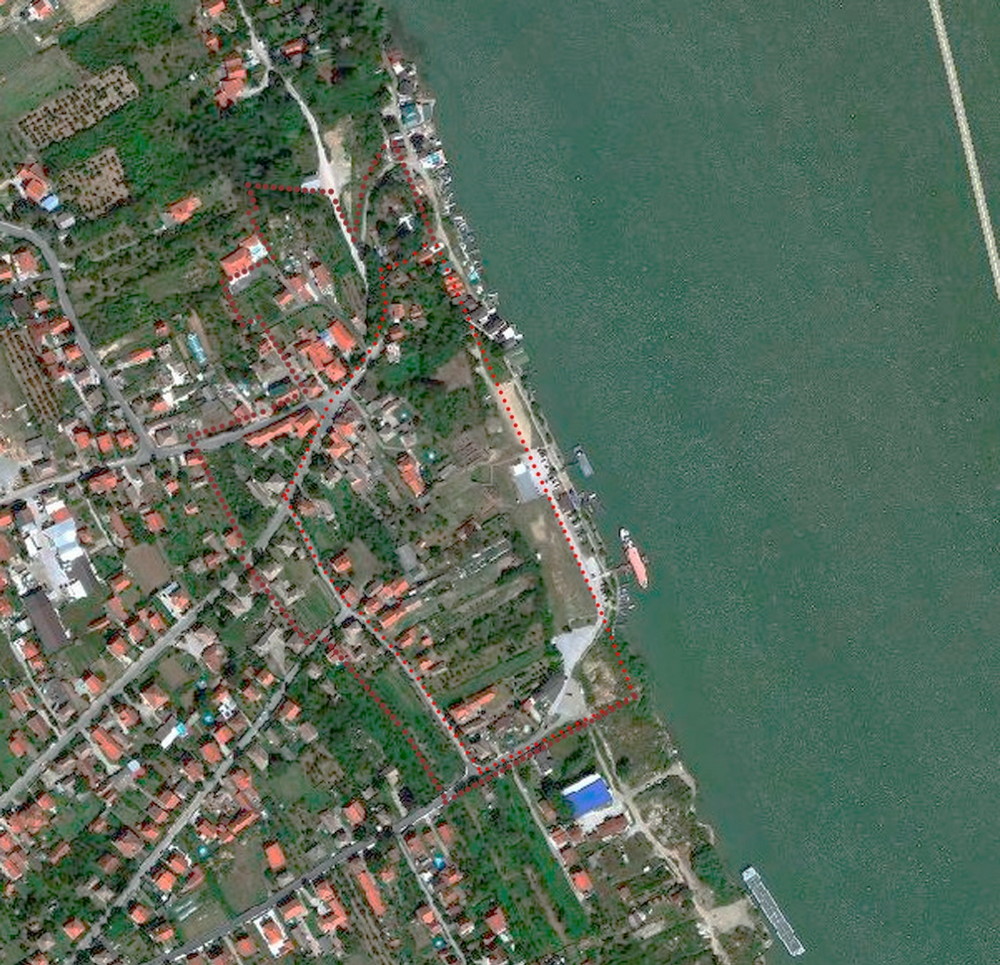
Fig. 34. Orthophoto image with the boundary of the archaeological site with the 1st and the 2nd degree of protection as the unit covered by the competition
The site in zone 1st degree of protection, as an area where explorations have been carried out continuously, constitutes the backbone of the future Belo Brdo Archaeological Park that will be used for further explorations and tourism.
The access to the site is possible from the west, using the existing road network, as well as from the direction of the Danube. The observing of the site from the water, in the context of the setting, provides a far better possibility to come up with conclusions about its character. Viewed from the shore, as it is approached, the archaeological site constitutes a high profile that rises from south to north, reaching the maximum height of 10 m in the central section of the site. Although this profile is partly covered in vegetation, the height and the configuration of the profile are clearly visible.
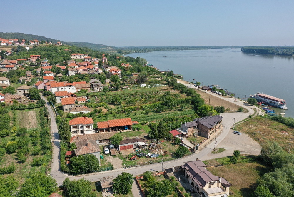
Fig. 35. Current state of affairs of the archaeological site Source: Archives of IPCMS
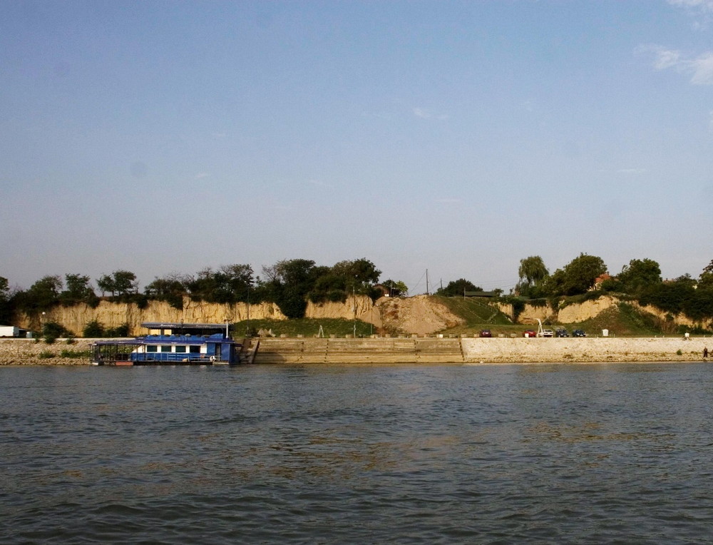
Fig. 36. Appearance of the high archaeological profile, 2009 source: Archives of the IPCMS
Under the present circumstances, the part of the subject space that is privately owned is used for housing – individual plots of land with single-family residential buildings, auxiliary facilities and gardens, while the part of the space that is owned by the state is used as orchards (cp no. 2026/4, 2026 / 5, 2026/6, 2027/2, 2027/4, 2048/2 and 2047/2 all of CM Vinča) and as the active area of the archaeological site where the explorations are carried out and that is visited by tourists (cp no. 2023/1, 2023/2, 2023/3, 2024 and 2025/2 all of CM Vinča).
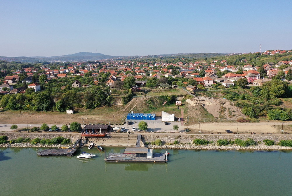
Fig. 37. Appearance of the high archaeological profile, 2021 source: Archives of the IPCMS
Currently, the archaeological site can be accessed solely from the side of the river bank, following Nikole Pašića street.
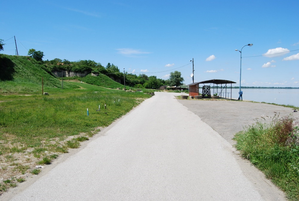
Fig. 38. Riverbank and the position of the archaeological site, view from the south side, 2014. Source: Archives of the IPCMS
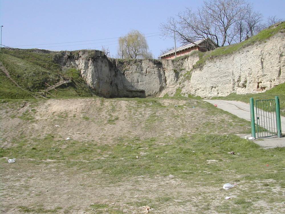
Fig. 39. Appearance of the archaeological profile, 2007 source: Archives of the IPCMS
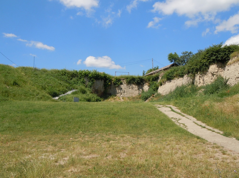
Fig. 40. Appearance of the archaeological profile, 2014 source: Archives of the IPCMS
The access from the north side comes across an archaeological profile of the plot of land in which the excavations were carried out from 2011 and in 2019. In this part of the profile it is possible to notice deep cracks caused by atmospheric and vegetation influences and the impact of the landslide in this part of the site.
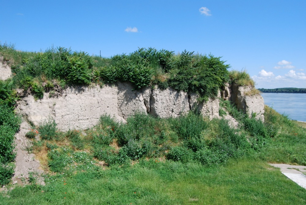
Fig. 41. Appearance of the atmospheric and erosion changes and vegetation influences in a part of the archaeological profile, 2014
Source: archives of the Institute for the Protection of Cultural Monuments of Serbia
The central part of the archaeological site was excavated until 2009 (cadastral parcel 2025/2 of CM Vinča). This area of 400 m2 represents a dug-out section up to 1.5 m deep, covered with geotextile, sand, gravel and geonet. In this way, the remains of the youngest phase of the Neolithic settlement are protected.
Along the western and northern edges of the plot of land, there is a group of temporary buildings distributed over a rectangular layout.
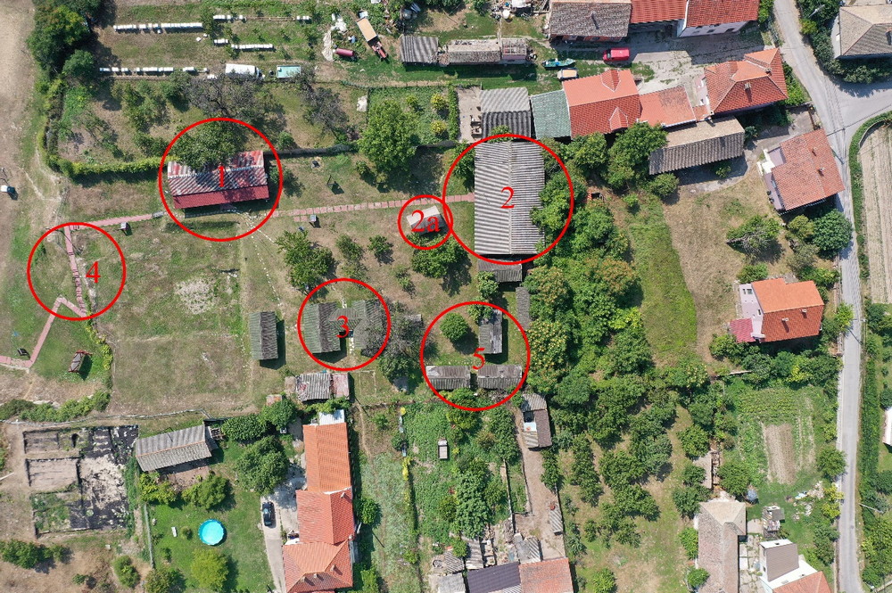
Fig. 42. Appearance of the current area where tourists are received: 1. Building housing the site’s security, 2. Museum exhibit, 2a. Neolithic house replicas, 3. Covered structures with benches, 4. Access stairs, 5. Storage facilities
Source: archives of the Institute for the Protection of Cultural Monuments of Serbia
The buildings are made of wood, with shallowly dug foundations. In the period when they were first assembled, they were used for the stay of the team members during the excavations and as working premises. Taking into consideration that nowadays they are mostly unsuitable, they are either used as storage facilities – for keeping soil samples and subsamples for flotation and further analyses, for drying materials after the excavation or they are empty.
In one of these buildings, on the western border of the plot, a new museological exhibition was opened in 2012 covering an area of 100 m2. It includes 260 exhibits from the latest excavations and parts of the structures that have been conserved and removed from the dig. A replica of a Neolithic house was made in front of the building in 2020. Information boards have been set up on the plateau and it is also used for occasional thematic exhibitions. This space is used to receive visitors, where the curator-guide talks about the archaeological site. In case of group visits, the central building is used – a covered space with benches.
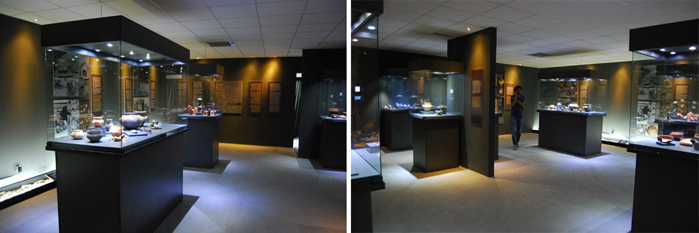
Fig. 43a, 43b. Exhibition area at the archaeological site opened for visitors in 2012 Source: Archives of the IPCMS
North of this plot is the area that has been explored since 2019 and a part of the site that is overgrown with vegetation. Also north and west of the central part of the site, there are privately owned plots of land with houses and auxiliary facilities.
The western part of the archaeological site, next to Belo Brdo Street, consists of plots with residential houses.
The cadastral parcels covered by the 1st degree of protection of the site that are not owned by the state are in various stages of expropriation, with the aim that all cadastral parcels within the scope of the 1st degree of protection become state property through expropriation as soon as possible.
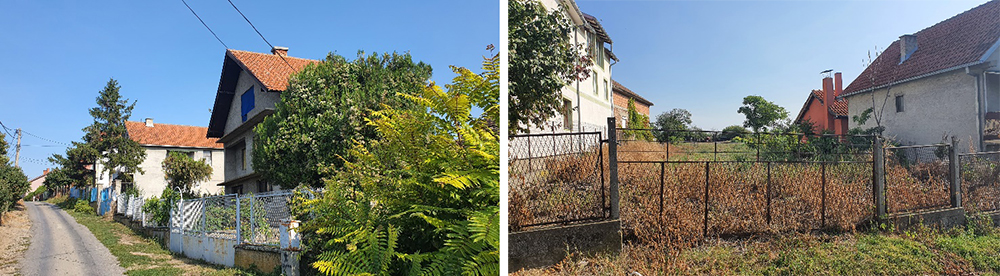
Fig. 44.a, 44.b Appearance of the west boundary of the archaeological site Source: Archives of the IPCMS
Area earmarked for the subunit of the Visitor Centre
The area earmarked for the Visitor Centre subunit covers the area of around 23,260 m2, it encompasses the area south of the archaeological site (1st degree of protection), from Nikole Pašića Street to the zone earmarked for the Archaeo Park, between the regulation of the archaeological site (1st degree of protection) in the east and the planned pedestrian path in the west. As regards the protection of the archaeological site, this area belongs to the 2nd (mostly) and the 3rd degree of protection. The zone intended for the construction of the Visitor Centre (within the scope of the 3rd degree of protection) consists of cadastral parcels no. 2028/14, 2028/15, 2028/16, 2028/47, 2028/48, 2028/77, 2028/120 of CM Vinča.
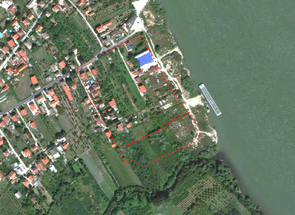
Fig. 45. Orthophoto image with the marked area intended for the Visitor Centre
The zone of the exterior area supporting the Visitor Centre, within the 2nd degree of protection, consists of cadastral parcels no. 2028/16, 2045/1, 2045/2, 2045/3, 2045/4, 2045/5, 2045/6, 2045/7, 2045/8, 2045/9, 2045/10, 2045/11, 2045/16, 2045/18, 2045/19, 2045/20, 2045/21, 2045/22, 2045/23, 2045/28, 2045/29, 2045/30, 2045/31, 2045/32 and a part of c.p. 2028/26, of CM Vinča.
In its current state, the area earmarked for the Visitor Centre represents undeveloped hinterland of the coastal zone and plots of land used for single-family housing, while the plot of land that stands out is the one containing a commercial building on cadastral parcel no. 2045/1, built before the establishment of the protected surroundings of the archaeological site (2009), which is not in operation today and is in a neglected state.
The new purpose of the area entails the removal of all existing facilities when adjusting the land to its purpose.
Area earmarked for the subunit of the Neolithic Scientific Research Centre
The area earmarked for the Neolithic Scientific and Research Centre subunit, with the total surface area of around 7900 m2, is situated at the crossroad of Profesora Vasića and Nikole Pašića streets and it includes cadastral parcels no. 2070/1 and 2070/4 of CM Vinča. Under the present circumstances, within the subject area there is the building of the old primary school (2070/1) that has not been used since the construction of the new primary school building and a building without characteristics linked to any purpose that is currently accommodated so that it can be used as the Post Office (2070/4).
The said structures have no architectural value. The new purpose of the area entails the removal of all existing structures.
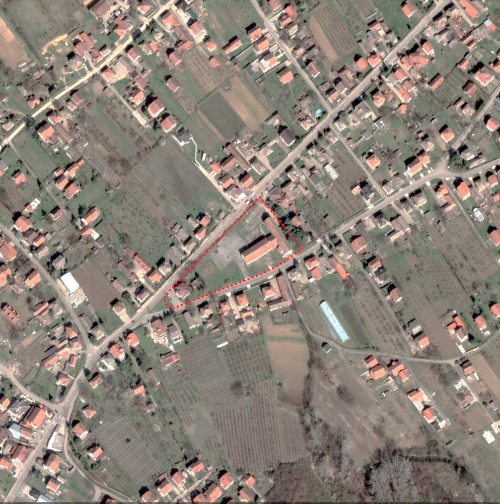
Fig. 46. Orthophoto image with the presentation of the area intended for the Neolithic Scientific and Research Centre
Areas intended for the subunit of the Coastal zone of the Danube
The Coastal zone of the Danube that is the subject of this competition with the planned use of the revetment, the promenade, green areas and the pier, encompasses the area between the regulation line of the low waters and the boundary of the archaeological site (1st degree of protection), from the confluence of the Bolečica in the south to the boundary of the area covered by the competition in the north.
In terms of water protection and urbanisation, this area was not adequately treated in the past. In the section of the riverbank next to the archaeological site, there is a segment of a partially formed revetment built during the 1980s, over the length of 260 m, with the crown elevation of 74 m above sea level. When observed from the Danube in the direction of the site, it consists of a promenade and a flat plateau that is 20-40 m wide. The current state of the Danube bank in this segment is such that the vertical section in the zone of the archaeological site, which is 7.0-10.0 m high, is temporarily supported from the flat plateau in order to prevent further landslides. Upstream from the revetment, over the length of around 200 m, the protection of the bank has been done up to the elevation of 72 m above sea level and this zone has been activated without any special development for the needs of the local population.
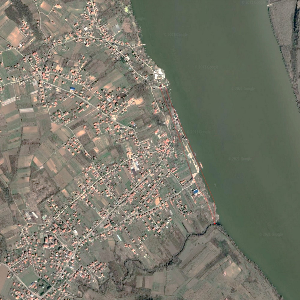
Fig. 47. Orthophoto image with the presentation of the coastal zone of the Danube in the area covered by the competition
The largest section of the riverbank in this zone is occupied by a green area which is used from time to time to install elements of a children’s playground. Right next to the river there is a paved path intended for pedestrians, which is used as a carriageway for vehicles, while a paved area in front of the entrance to the archaeological site is used as a parking lot. During the archaeological excavations, construction containers needed for the stay of the expert team are placed on this surface.
In the north part of this area, there are structures built partly on the riverbank, partly above the water (stilt houses), used as holiday homes and restaurants, and they are a product of illegal construction and do not have a use permit. A dozen structures, densely lined up next to each other, have also been built on a part of the riverbank next to the archaeological site, also illegally and without a use permit.
Several structures have been set up on the river, along the revetment.
When observed from the south upstream, the first structure is a dock for smaller vessels. This dock, placed on piles in 2020, which was organised by and for the needs of the Museum of the City of Belgrade. In the context of this Competition, the position and purpose of this dock are binding.
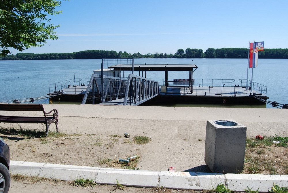
Fig. 48. Pontoon – the dock installed in 2020 Source: archives of the Institute for the Protection of Cultural Monuments of Serbia
The next structure on the water, the first north of the dock, is a ship-restaurant “Srbija” that operates solely at this location. The ship-restaurant is connected with the land by a pedestrian bridge and it is located at the subject site without a permit.
The structure on the water north of the ship-restaurant “Srbija,” a small pontoon, is used as the terrace of restaurant “Maestral” positioned on the dry land. The structures has a seasonal character and does not have a use permit.
Area earmarked for the subunit of the Archaeo Park
The zone earmarked for the Archaeo Park subunit covers the area in the hinterland of the Bolečica’s left bank zone, from the boundary of the SPSPA for Belo Brdo Archaeological Park to the north, and it consists of cadastral parcels no. 2028/5, 2028/6, 2028/23, 2028/24, 2028/30, 2028/32, 2028/69, 2028/110 of CM Vinča and parts of cadastral parcels no. 2028/18, 2028/19, 2028/20, 2028/21, 2028/22, 2028/23, 2028/25, 2028/33, 2028/34, 2028/35, 2028/37, 2028/70, 2028/84, 2028/85, 2028/86, 2028/109 and 2028/111, in a total area of 65 880 m2.
Under the present circumstances, the subject area is owned by private individuals and it is used as of agricultural arable land.
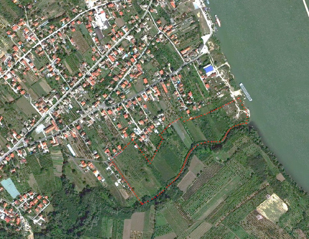
Fig. 49. Orthophoto image with the presentation of the area intended for the archaeo park
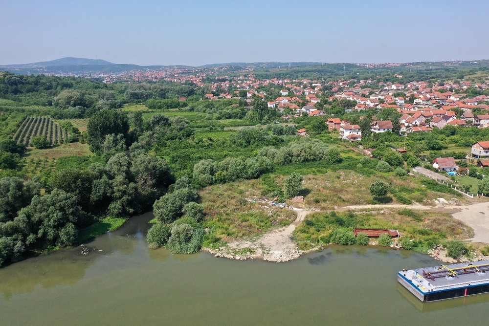
Fig. 50. Confluence of the Bolečica and the Danube, view to the west source: Archives of the IPCMS